
It is 1959. Midnight is approaching and I am standing beside the venerable and lonely graves on Howard Street, a narrow sandy lane in Ocracoke village. Silence has descended upon the graveyards, covering the dead like a heavy blanket. Menacing storm clouds scud across the heavens threatening to obscure the full moon which hangs heavy in the sky. I am fifteen years old and my trembling hands rest on an ancient wooden fence. Several pickets are broken, others are missing. Most are covered with pale mosses and lichens. A gate hangs forlornly from one rusty hinge. The scent of decay floats in the air. I am peering intently into the semi-darkness, into my own family graveyard on this deserted lane.
Live oaks and cedars reach above my head, forming a dark tunnel. The graveyards are overgrown with briars and grapevines and weeds. They have been so for centuries. But I blink my eyes…and curiously the scene changes.
The marble and granite markers are now stretched out on the trackless bald beach. For miles there is nothing but tombstones and tidal flats…and a few low dunes crowned with sea oats bending under the assault of the west wind. Beyond is the angry, churning Atlantic Ocean. I am gazing not only into a dream world, but also into the past, into the "time of the blowing sand."
As I watch, the wind sweeps away the sand in front of a timeworn marble tombstone. Slowly an unfamiliar object emerges from the ground. It is a skull. The sand swirls and spirals upwards, carried away by the howling wind. More and more of the skeleton lies exposed. The rib cage, the pelvis, the arms, the legs. The skull turns slowly and deliberately in my direction. Its vacant, hollow eye sockets seem to lock me in a penetrating gaze.
Terrified, I watch as the bones rise slowly from the grave and move in my direction. The fence has disappeared. Nothing but sandy soil separates me from this dreaded creature.
Suddenly the skeleton raises its arms and lunges toward me. I step backwards just in time to evade its grasp. Now I am retreating quickly.
It is then that I notice an especially peculiar detail. The skeleton has no fingertips. The other bones are there, but the ends of the skeleton's fingers are missing. Somehow this makes the horror even more terrifying. I turn and run away. The skeleton chases. I know it is after me, close on my heels. Faster and faster I run, through silent burying grounds, across sand flats, then past abandoned, weathered old houses with windows missing and doors ajar, farther onto the bald beach.
And then I disappear, engulfed by a blinding sandstorm.
I awake…sweating, my heart racing. It takes me an hour or more to return to sleep.
I have the dream not once, not twice, but often. Always the same. Always that skeleton rising from the swirling sand and chasing me with upraised arms, always missing the tips of its fingers.
In a way familiar to anyone who has ever had a nightmare, my dream of the skeleton rising from the grave was a strange mixture of images. I was standing by the graveyards on historic Howard Street. Suddenly the cemeteries and I were transformed, and I was standing alone on the edge of the bald beach at the time of the blowing sand, an era in Ocracoke's history of dramatic environmental and social change.
Ocracoke Island has always been a dynamic, evolving place. Little was understood about the constantly changing Outer Banks in 1719 when a tract of land containing 2,110 acres was conveyed by the Lords Proprietors to John Lovick. This grant was for land "[b]eginning at Hatteras Inlet and running to Occacok Inlet," what we today would call Ocracoke Island.
In 1721 Lovick sold the island to Charles Eden, Governor of North Carolina, but somehow got it back again after Eden's death in 1722. Lovick then sold Ocracoke to Richard Sanderson who deeded one half of the island to the privateer Roger Kenyon in 1723. By some now long-forgotten transaction, Sanderson obtained full ownership of Ocracoke again, before his death in 1733. At that time "Ye Island of Ocreecock, with all the stock of horses, sheep, cattle and hoggs" was bequeathed to his son, Richard Sanderson.
There is no evidence that John Lovick, Governor Eden, Roger Kenyon or either of the Sandersons ever made their homes on the island.
On July 13, 1759 Richard Sanderson, Jr. sold his 2,110 acres to William Howard, Sr. for £105.
It is difficult to determine exactly what was granted and sold in this early period of Ocracoke's history. Violent storms, accompanied by strong winds and rushing tides are constantly shaping and reshaping these fragile barrier islands. The only Outer Banks inlet that has been continuously open since Europeans began keeping records is Ocracoke Inlet.
Present-day Hatteras Inlet was opened by a fierce storm in 1846. Prior to that time other inlets existed, and the north end of what is now Ocracoke Island and the south end of Hatteras Island were connected, creating an intermediate island.
Today there are seven tidal creeks on Ocracoke Island that intersect North Carolina Highway 12. From north to south they are Try Yard Creek, Parker's Creek, Quawk's Point Creek, Molasses Creek, Old Hammock Creek, Shad Hole Creek (now mostly dried up), and Island Creek.
Although these creeks are open to Pamlico Sound they do not extend all the way to the Atlantic Ocean. They are undoubtedly remnants of previous inlets. In 1759 Ocracoke Island was approximately half of its present length (today it is about sixteen miles long). At that time a true inlet must have existed in the area where one of the northernmost creeks flows today.
Present day Ocracoke Island includes about 5,535 acres. If we exclude the village of Ocracoke (which consists of about 775 acres) we are left with 4,760 acres of "sandy banks." Half of this is 2,380 acres, very close to the area recorded in the earliest deeds.
In 1795 Jonathan Price produced a detailed map of Ocracoke Inlet, accompanied by a description of the area. Referring to the village and its surroundings, Price wrote, "Occacock was heretofore, and still retains the name of, an island. It is now a peninsula; a heap of sand having gradually filled up the space which divided it from the bank. It continues to have its former appearance from the sea; the green trees, that cover it, strikingly distinguishing it from the sandy bank to which it has been joined. Its length is three miles, and its breadth two and one half. Small live oak and cedar grow abundantly over it, and it contains several swamps and rich marshes, which might be cultivated to great advantage; but its inhabitants, depending on another element for their support, suffer the earth to remain in its natural state. They are all pilots; and their number of head of families is about thirty."
This description presents some confusion for the modern reader. Ocracoke (historically spelled many different ways, including Occacok, Ocreecock, and Occacock) seems to refer sometimes to the sandy banks and at other times to a separate island where Ocracoke village is located today. Clearly Price uses Occacock to mean the village area. In contrast, earlier deeds for Occacok and Ocreecock probably referred only to the sandy banks.
This naturally leads to speculation that William Howard, last colonial owner of Ocracoke, and the first owner to live on the island, may have already been living in the nascent village when he purchased an additional 2,110 acres of the sandy banks in 1759.
In 1715 the North Carolina Colonial Assembly passed an act for "settling and maintaining Pilots at…Ocacock Inlett." Piracy was ascendant at that time, and legislators recognized that the remote and unprotected outer islands were vulnerable to the depredations of unsavory characters. As late as 1753 the Colonial Assembly was still mentioning "Insults from Pirates and other rude People" as one of the justifications for appropriating funds to build a fortification on nearby Portsmouth Island.
In 1718 Blackbeard and other buccaneers were so effectively terrorizing the coast of North Carolina that few colonists were willing to risk life and property to move to Ocracoke. It was not until sometime in the 1730s that the first pilots made permanent settlements on the island.
William Howard was likely one of these first pilots. Research suggests that he was born about 1686 and was almost certainly the same William Howard who served as Blackbeard's quartermaster in 1717 and 1718. Captured in the summer of 1718, Howard was tried and sentenced to death in Williamsburg, Virginia. Since he was confined to jail in November of 1718 when Blackbeard was overtaken and killed near Ocracoke Inlet, William Howard was spared death in Blackbeard's final battle. Howard's life was saved again when the king's "Act of Grace" arrived in the colonies the day before his execution in December. After his release he may have spent time in both Maryland and North Carolina, but there is nothing to suggest that he ever returned to piracy.
In his seventies when he purchased land from Richard Sanderson, William Howard seems by then to have been well established on Ocracoke. It is difficult to believe that at that age he suddenly moved from the mainland, along with his entire family, to this remote barrier island. More likely, he had settled on the island as a younger man, had accumulated extra funds, and finally had the opportunity to increase his holdings.
An undated newspaper article written by Ocracoke native Amasa Fulcher (1876-1946) states that the conveyance of 2,110 acres of land lying between Hatteras and Ocracoke Inlets ("Ye Island of Ocreecock") "leads us to believe that at this time [the early 1700s] there was an Inlet just north of the neighborhood where is now located what we call the Plains [the area from the edge of the village to the National Park Service Campground]."
Fulcher goes on to say that "[o]lder people of Ocracoke used to refer to this section as Nigh Inlet, and…Hatteras Inlet…was located south of the Hatteras Inlet Coast Guard station...."
According to older island residents, their parents and grandparents would sometimes remark that very many years ago grape vines and other vegetation grew so thick that they formed sturdy mats in the trees that children routinely played in. Several reports have survived that a thick mat of vines and briars originating in the trees near the graveyards on Howard Street was so extensive that it was common for young boys to climb to the top and crawl all the way to the sea.
Islanders of today often wonder how that could be. The Atlantic Ocean is almost three quarters of a mile from the southeastern end of present-day Howard Street. Furthermore, in the mid-twentieth century fully half of that distance, the area of the island that extended from the edge of the village (where Old Beach Road is located today) to the ocean, was a wide tidal flat virtually devoid of vegetation.
How could it be that grapevines at one time extended to the very edge of the sea?
In 1795 Jonathan Price wrote of the "small live oak and cedar" which "grow abundantly over [the village]." The vegetation in the area of the village was at that time, and still is, noticeably different from the natural vegetation on the "banks." In contrast to the barren tidal flats and occasional dunes covered by sea oats and other highly salt tolerant plants and grasses, the "live oak[s] and cedar[s]" and the "swamps and rich marshes" of the village suggest a different geologic formation.
The "sea" must have meant, not the Atlantic Ocean, but a channel of water separating Ocracoke village from the sandy banks. At the end of the eighteenth century, when just a handful of hearty souls were calling Ocracoke home, the village area, once a separate island, seems to have become connected to the banks by a buildup of sand, and Price described it as a peninsula.
But that area was inherently unstable and over the next century and a half the waterway that had once separated Ocracoke village from the banks continued to advance and retreat, the buildup of sand periodically reverting to a swash or channel between the banks and the village.
The dynamic nature of the North Carolina Outer Banks is apparent in the changing shape of Ocracoke Island. As late as the 1970s and early 1980s the area between the edge of the village and the airstrip (including North Carolina Highway 12) would often be covered with salt water during storms and exceptionally high tides.
Only in the 1980s did engineers stop the process by building up the roadbed of NC Highway 12, limiting vehicle traffic to one raised corridor to the South Point, and encouraging the introduction of grasses, shrubs, and trees in the low lying areas nearby.
For many years, from the early eighteenth century until the mid-twentieth century, grazing livestock would have periodically been able to wander across tidal flats, or even a shallow swash, from the sandy banks into Ocracoke village, and back again.
Unfortunately, the introduced livestock population increased rapidly, and much of the island's natural vegetation was soon eradicated due to overgrazing. Sheep were especially destructive, but goats, cattle, and horses contributed to the problem as well. In addition, demand for lumber, especially southern live oak for shipbuilding, hastened denuding of the island landscape.
During the eighteenth century the British Navy engaged in a practice called "live oaking." Hardwoods were aggressively harvested in the colonies for ships. In particular, shipbuilders sought live oaks. The felled logs were tied together in bundles and carried offshore where they were set adrift in the Gulf Stream. From there they would float across the Atlantic. A goodly number of the bundles actually arrived on the west coast of England where the British Navy gathered them and turned them into ship timbers.
Ocracoke Islanders have passed down stories of early shipbuilders and their agents who walked from house to house examining the many live oaks that grew in the village. When they spotted a tree that was especially large, or that grew in such a way as to produce one or more natural "knees," an important component of tall ships and schooners, they would approach the homeowner and offer an enticing sum to purchase the tree.
In this way a number of Ocracoke's majestic old-growth live oaks were harvested in the 1700s and the early- to mid-1800s. This, coupled with overgrazing, had disastrous results. By the end of the nineteenth century so much of the island had been stripped of its vegetation that islanders began referring to this period as the time of the blowing sand.
Homeowners who had built on the eastern edge of Ocracoke village, an area that had originally been covered by trees, bushes, and thick undergrowth, slowly found themselves confronted with a desert-like landscape. Villagers would wake in the morning to find sand piled around their houses, often so deep that it was impossible to open the doors. It drifted through cracks in the walls and passed through openings around windows and doors. Eventually fine sand covered some houses up to the windowsills.
Much of the original wide mat of grape vines was gone. Now there was a mile or more of bald beach extending from the edge of the village all the way to the Atlantic Ocean.
Many of Ocracoke's Bragg family, whose ancestors had called Ocracoke home since the late 1700s, found their land overtaken with the blowing sand. Their property included a wide swath from the present-day School Road to beyond Cedar Road, where the East Carolina Bank sits today. As the bald beach advanced, the Braggs gradually abandoned their homes and moved closer to Cockle Creek (Silver Lake). Sometimes they dismantled their houses and rebuilt them at a safer distance from the bare beach. At other times they would set a house down on sturdy logs, hook a team of horses to it, and roll the house to a new location. Often they simply allowed nature to claim their homes.
Particularly distressing during this time was the state of the Bragg family cemeteries. Strong, unrelenting winds blew steadily over their graves, slowly uncovering them. Residents periodically discovered caskets protruding from the blowing sand. At older gravesites the caskets had deteriorated, and skulls and other bones were sometimes exposed. Islanders recall hearing stories about a woman's body that was swept clean of its sandy covering. Some even remember that for a time her matted red hair could be seen fluttering wildly in the frigid winter wind.
Eventually the Bragg family contacted some of the Howards and asked for land to bury their dead. Close examination of the graveyards on Howard Street today reveals more than a half dozen Bragg tombstones.
Several years ago I was sitting in the parlor of my cousin's 90 year old house on Howard Street, a pile of genealogical papers spread out on her card table. Talk turned to relatives long dead and old family stories. One thing led to another, and directly we were discussing the graveyards on Howard Street…and the distant ancestors buried there.
She reminded me of a particularly interesting story about the burial of my Uncle Evans in 1923, a story in which my immediate family played a significant role. I had heard it many times, but somehow I had never made the obvious connection between this story and my distressing dream of the skeleton without its finger bones…until that moment.
But the conclusion of this story is best saved until the end of the book, or, better yet, the end of the day…best saved until that timeless period between the half-light of a dying day and the murky darkness of the witching hour.
So please, light your oil lamp, settle down in a comfortable chair, turn the page, and enjoy these authentic tales, maritime history, and stories from Ocracoke Island.
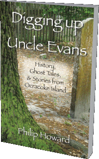
Order your copy now.
You can contact Philip at pip@blacksquallbooks.com or at PO Box 248, Ocracoke, NC 27960
